Big Savage Hiking Trail Backpack, Maryland

Update, March 20, 2008:

I have notice a heck of a lot of hits to this blog regarding this trail. This blog is not one of those informative trail sites but there seems to be an incredible lack of information on the Internet about this place. I was shocked and horrified to read that someone else is actually charging money for information regarding The Big Savage Trail. So I have created a hand drawn downloadable map that is not exact, but exact enough for hiking purposes. I have also created 2 maps to the termini of the trailheads. This should clear up some confusion and hopefully save somebody some money.

Trail map:


Map to north trailhead:


Map and directions to southern trail head, I'm doing this from memory:
Go to the campground on north side of Savage River Road. Drive into campground and head west (left) as far as you can go on the campground loop. Looking west along the Savage River you will see a gate, I think it is yellow. Park your car. Beyond the gate is a road. Stay on the road and when you get near the Savage Dam you will see a sign for the trail.


This was a hike hosted by The Outdoors Club led by your's truly. You can find a good trail description for the Big Savage Hikiing Trail on Big Savage Mountain near Frostburg, MD in this PATC book. However, let me add some additional comments. Due to what looks like a serious gypsy moth infestation, the tree canopy is pretty shot leaving some serious undergrowth. A good portion of the 17 mile trail is overgrown with briars so wear thick long pants or bring lots of bandaids. I would not attempt this trail in the summer. Sometime between the last time and time2 I was on this trail and now a kind soul took a great deal of time and effort and marked this trail very well, so at least you will know where you are going. The trail marking was a pleasant surprise.


This time I was determined walk the entire trail end to end. Thankfully I had all these unsuspecting people to help out with transportation and logistics. On the hike were Tuna, Hungry Ted, Keith, Lisa, Kisses and Jada. Since we were 4 days away from the shortest day of the year we were forced to put more than a little spring in our step. We started at St. John Rock and headed south. The book said there would be good camping on the ridge at mile 11, all we found were a lot of briars and undergrowth but we were successful finding enough space directly on a logging road.

I know that many of you who know us have come to this site to get the dirt on what happened. Unfortunately too many of the participants have significant others so I am forced to keep my mouth shut. I will say that I have never seen so much alcohol brought for a one-night backpack, things got rolling early due to the 5PM sunset.

The next day we visited the High Rock Tower.
I managed to climb up to level 2 and then refused to go any further, the tower seems more than a little dangerous. Lisa was the only one who made it all the way to the top. At the bottom I made another video interview with Keith, a trail overseer with the PATC Cadillac Crew. If you want to learn about being a trail overseer take a look.

Patapsco Valley State Park, Maryland

This weekend I had to stay home to get some thing done, but I did want to check out a new GPS system that I created. I'm using a Palm TX, Holux slim236 bluetooth GPS and Delorme TOPO USA 6.0. Everything worked fine at the house, even inside the house but I wanted to give it a try in the forest close to home before I wanted to rely on it out in the hinterlands. The Holux is probably the strongest GPS satellite sucker on the market that I can tell.

My hunter friend volunteered to test the GPS system with me and we started out this morning in the Avalon area of Patapsco Valley State Park. We decided we wanted to take a look at some waterfalls in a ravine. I was unable to pull in a satellite signal until we got on top of the ridge. But once it came in, it stayed in. The Holux stayed in my pocket the whole time, unlike Garmins where you have to keep them outside and then they don't work even then.

We shot a video for your enjoyment.


My hunter friend is very concerned about tracking deer, so we ended up looking for signs of deer and looking at rub areas on trees. I didn't think much would come of all this, but sure enough, we got to the top of a ridge and there was a nice big buck. Hunter friend got all excited. We trampled through the woods, ignoring the trails and zigzagged across the park. We watched the geese and ducks in the frozen pond too.

Massanutten Trail West and Antietam Battlefield

When on the Massunutten Trail East a few weeks ago I got a good look at the west ridge and decided to check it out. I set out in the dark Friday night and managed to park my minivan at the very top of Woodstock Gap near the tower, so I had a beautiful view of the lights on both side of the ridge. I set out on the Massanutten Trail heading south on Powell Mountain early because of the limited daylight and realized the trail was going to be a slip and slide due to an excessive amount of newly fallen oak leaves. I made this video for your enjoyment:

A ran into a couple of hunters around 10:30AM, although I can't imagine they were having much success that air was alit with the noisy sounds of many ATVs and bambi has never hung out on a steep ridge of a mountain, I have never seen a deer midmorning either. Maybe these guys knew something I didn't or they weren't the brightest bulbs. I had to climb Opechee peak because I had seen this pretty peak from the other trail. Although you can only get to it on the ATV trail which is a long road of annoying scree, it is well worth the climb. I also saw some hang gliders and paragliders along the way, there must be a ramp around somewhere.

I managed in the neighborhood of 15-16 miles before I gave up at 3PM. I spent the night in Front Royal which has proved to be a pretty good place to hang out, the Daily Grind downtown is open until 9:30PM and the streets over there are relatively quiet. The good news is that they are currently building a Wal-Mart which will come in handy. Now if they only will build a decent Sheetz.

I decided to play tourist the next day and visit Antietam. Battlefields tend to put me to sleep but I am trying to make use of my parks pass. I watched the NPS official Antietam movie and they made it sound like the Civil War was about the struggle over slavery. Nothing is further from the truth, that war like every other war was about ego and testerone much like our present war. All it takes is one maniacal power hungry dimwit from the south to come up with a dumb idea and thousands of people lose their lives waving the American flag. If you think for a minute that the Civil War soldiers or those Iraqi troops were/are fighting for "freedom" you better think again. Fail to fill out a 1040 form on April 15th and you will find out just how not free you are.

I made a little video in the cornfield. Several troops on both sides were sent to battle each other at close range even though their weaponry could have been used yards away. Nobody could see anything in the cornfield because of...the corn. Nobody knew who they were maiming and killing.


Here are 2 more pics. The first is picture of Bloody Lane which is all of a few hundred feet long. 5000 soldiers lost their lives over this pathetic piece of farmland.
This next pic is of Burnside Bridge where a bunch more people lost their lives over a tiny little bridge. I am sure some of those soldiers must have thought at one point, WTF am I doing here?

Bear Run Nature Reserve, Pennsylvania

Did you expect me to have a 4 day weekend without fitting in a hike somewhere? You know me better than that.

I contacted more than a few hiking clubs in the Pittsburgh area begging for someone to take me hiking. Unfortunately, I asked for a long hike with lots of elevation changes and, well, the Pittsburgh hikers thought I was nuts. However, the Allegheny Sierra Club claimed to have a 9 miler at the Bear Run Reserve near Ohiopyle on Sunday. I tried to call the hike leader but his phone wasn't working properly, all I got was a beep. But that didn't deter me, I figured I would find the place and show up, which I did.

The Sierra Club didn't show up, but one other person was there looking for them too. So we went on a hike together. This unassuming nice hiker named John probably didn't quite understand what he had gotten into when he agreed to go hiking with me. After 10 minutes of hiking we had lost the trail so I suggested an nice bushwhack(after a Ranger Lady told me not to bushwhack) through the woods which was sucessful, we found the trail. This nature reserve boasts a good set of trails and you can actually squeeze out a 10 mile loop with about a thousand feet of elevation change. The western perimeter of the property abuts the Youghiogheny River but the trail stands about 100 feet above the water so you can get a good view in winter. Unfortunately, there is also some railroad tracks so it can be a little noisy with the trains.

On my way home I stopped in Ohiopyle to take a closer look at the 43 mileYoughiogheny River Trail which is a crushed stone bike trail very much like the NCR. I went into a store and asked about the possibility of tubing and someone informed me that tubes aren't allowed. The place would be idea for my one of my tube and bike extravaganzas, it's a shame. I did see a few people kayaking in the very cold water which means there are some hardcores around here. I will need to do some more exploring next summer.

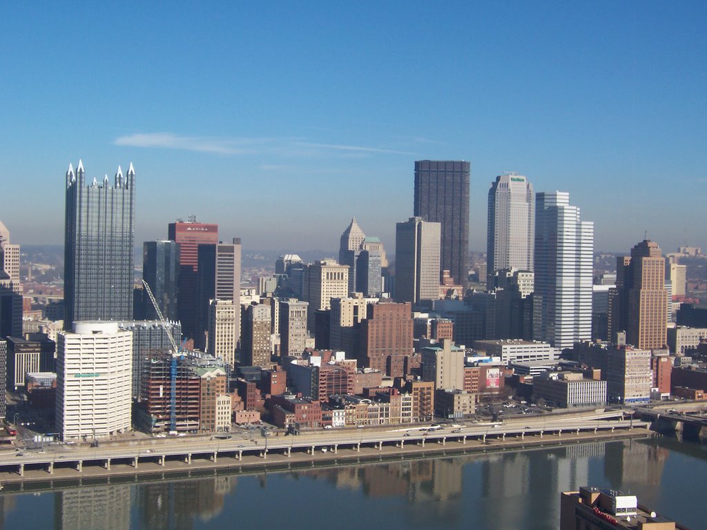
Pittsburgh, PA

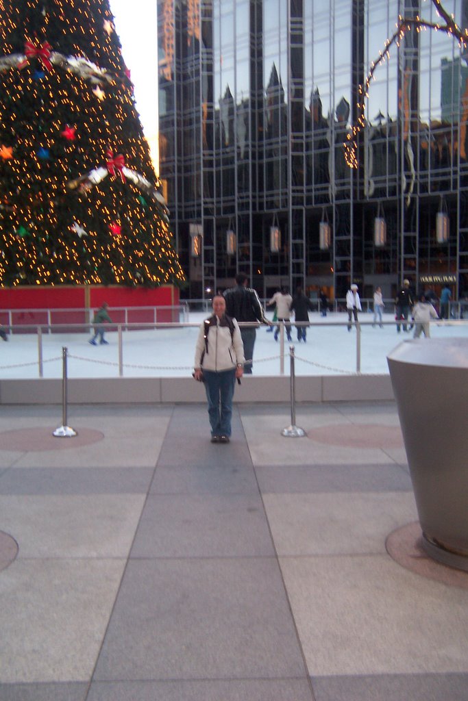
I have failed to visit the glorious city of Pittsburgh for the last 25 years. Why? Well, for a not so good reason. I used to date this guy who went to Carnegie Mellon. One day while I was visiting him on campus he got down on bended knee and asked me to marry him. He painted this picture of our life together where he would go to PhD school for then next 10 years and how I would get a job to support us, clean the house and raise our children while he busied himself with his studies. He told me I would make a wonderful wife and mother to our unborn children. Needless to say, the day he proposed was the day I broke a landspeed record by car out of Pittsburgh and I haven't been back since. This left a bad taste in my mouth about Pittsburgh which is a perfectly good city and didn't deserve my ire.


Now that Rick Santorum is out of office I felt it was safe to go back. Pittsburgh was a town never meant for tourists, but that doesn't mean ignore it. The place was built so that a few people could get rich off the backs of unsuspecting immigrants from Europe during the Industrial Revolution. The Carnegies, the Mellons, and God knows who else would build these megafactories that cranked out steel, ketchup and other goods that the rest of the country needed, and these folks somehow convinced these Europeans that toil in a miserable place under miserable conditions was a good idea.

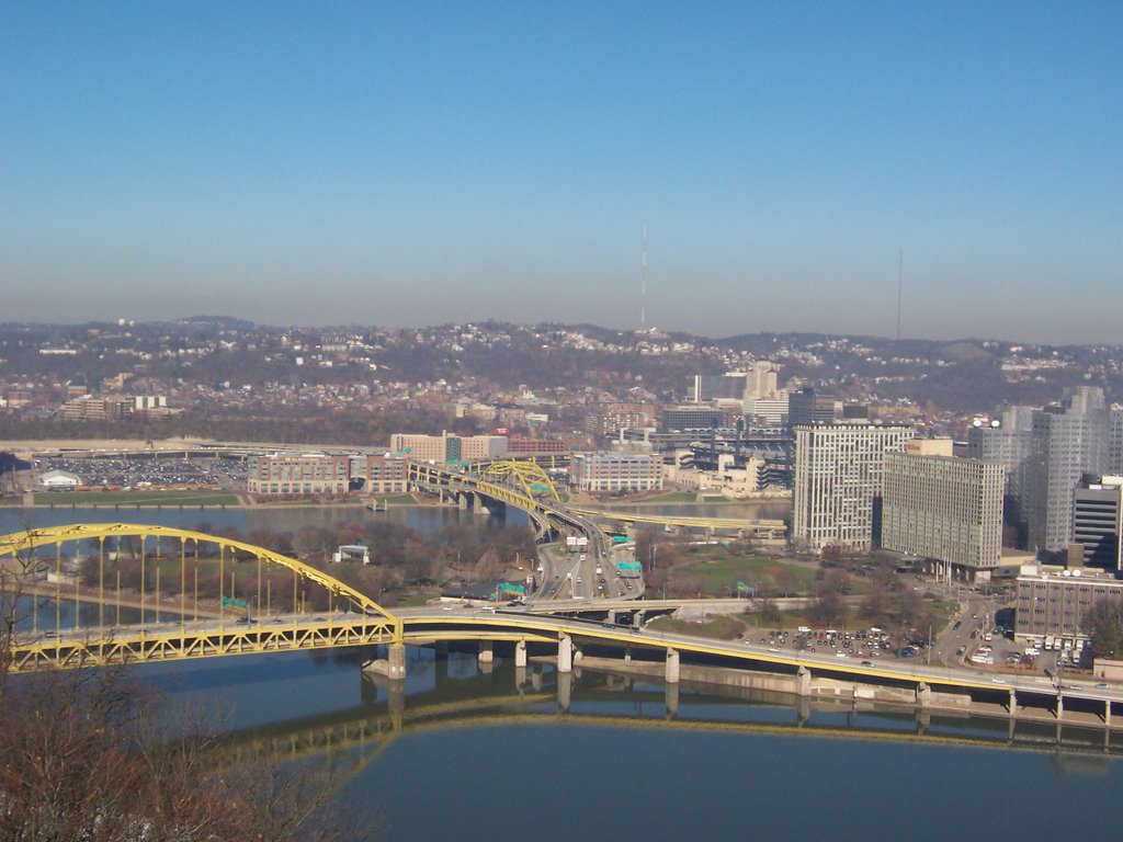
Since Pittsburgh never cared how comfortable and pleasant it was, it used the wonderful riverbanks to place some rather ugly highways and railroad tracks. Consequently nobody gets access to the waterfront. I am not this situation can be fixed, all I know is that if I were a politician I'd be making a big deal out of relocating some roads and trains somehow.

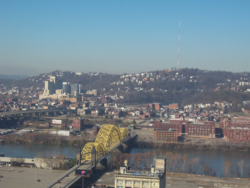
But the real star of the show isn't the waterfront or lack there of, but the edifices the immigrants built. It would take me a month and a much better camera to do justice to the many churches, factories, homes and halls that these people created. The immigrants that came to Pittsburgh were Germans, Italians, Slovaks and Russians. They knew exactly what to do with all the stone and brick lying around and boy did they build and build and build. Even the old factories are amazing with all sorts of architectual delights.

These folks liked to outdo each other, the German church had to be bigger than the Ukranian church next door. I guess what was being told to these people was that your life sucks now but if you work really really hard at the factory you would go to heaven and life will be much better. After a few years Pittsburghians quit believing in this BS and quit going to church. The steel industry took a nosedive and the locals decided that they should move elsewhere and get degrees in computers and move to Maryland, which is where many of them are located now. So many of these huge building stand empty. The vacated churches are being transformed into homes and bars so they get a new lease on life.


However, people, this place has some wonderful real estate bargains, probably because there aren't that many jobs in Pittsburgh. So if you are looking for some cheap living and a reasonably pleasant place you should look into Pittsburgh. This is primarly why I was there, to help my friend from New York take a long hard look at a more manageable place to live.

I wonder if they let people kayak on those rivers? I'll check into it.

Lucky for me I left on Saturday night, it was a good decision because the Ravens thoroughly humiliated the Steelers the next day 27-0, and I didn't want anyone to cap my ass, driving around with the Maryland tags. They take their football very seriously.