Quetzaltenango(Xela), Highpointing Central America at Volcan Tajumulco

Things are well, Terry and I went to visit the most mountainous region of Guatemala at Quetzaltenango but all the locals call it Xela (Shea-la). Really, I hadnt planned to do anymore serious hiking but when I learned that the highest point in Central America was just a few miles from where I was I decided that an ascent was imminent. I think I need a 12 step program, Hikers Anonymous.


On Monday I dragged poor Terry around from trekking service to trekking service to find someone that was willing to do what I wanted, when I wanted and how I wanted it done. I have never heard "Its not possible" so many times in my life. Finally I found a place called Atlantida Travel on 14 Av. that was willing to help me out. Hansy, the trekking arranger, said he would make a few phone calls and came up with a wonderful man named Mynor who was willing to meet my at 5AM on Tuesday and run me around in more than a few chicken busses to get me where I needed to be. Thank you both!!!!


Now these numbers are estimates at best as I am doing conversions, but the Volcan Tajumulco is 4220 meters high which is 4220mx3.3ft/m= 13,926 ft. We started around 9800 feet yielding a 4100 feet rise, 5 miles up 6 miles back(different return trip). Now if you read the rest of the blog one would assume that this should be a piece of cake for ole Cham. Wrong!

I learned things are a little different at 13900 feet than they are at 4000 feet. Needless to say I spent most of the hike gasping for air. Mynor must have thought I was a hiking lightweight. It took me 5.5 hours to get to the top, but I redeemed myself by only taking 2 hours on the downhill. If you are wondering what the top of the Volcan looks like here it is:


The place is really beautiful, nobody was there other than a few local people and their mules, some collecting firewood. Kudos to Mynor for putting up with me and chasing the chicken busses.


Right now I am back at Panajachel getting my laundry done and I just made arrangement to fly to Tekal tomorrow from Guate City. Terry left yesterday to return since his play is opening in Camden on Friday, I wish him luck with it.

Panajachel, Santiago de Atitlan, San Pedro

We´ve been hanging in Pana for 3 days and will leave tomorrow. Jesus has been very busy. First he was dragging his cross around and yesterday he was busy bleeding to death. I know because the Catholics have been very busy carrying around the story for us. First they make these pretty murals in the street using some sort of pretty colored material, I´m not sure what it is, then they carry their floats over it. All the while burning lots and lots of incense.


The Guatemalans got very busy with carry Jesus, today is Saturday and we are getting a reprieve, they were out 3 times yesterday, Good Friday, one trip was at midnight last night. I think they will be going like gangbusters on Easter Sunday.


The ladies here all where colorful outfits, here are some by a stall in Santiago de Atitlan, another town on Lake Atitlan that we traveled by boat here


We also went to San Pedro by boat. Here is a picture of a fancy church they are building. Many of the houses and businesses are open air because the weather is perfect all the time.


Yesterday we went kayaking, Terry was a very good sport considering his ankles are still hurting from the volcano hike. Here is a picture of Volcan San Pedro from the kayak. Please be advised, one day I will go on vacation to Central or South America and not come back. I haven´t seen one morbidly obese Gringo or Guat since I got here. Life is good.


(note to self: take another spanish class)

Antigua, Volcan Pacaya, Panajachel, Lago Atitlan Guatemala


I had a relatively uneventful trip here, I am a few miles west of Guatemala City, holy week is just swinging into full gear. The banks, stores, many of the hotels, stores have shut down for 5 days. The city is getting ready for a full processional (parade) today , the muchachos had their processional yesterday lugging all sorts of christlike things around the park on their backs.


I made Terry head straight for the volcano yesterday since my only special wish for my trip was to see burning lava. We took a bus tour of Volcan Pacaya . Either way it is southwest of Antigua. The bus dropped us off about 2000 feet from the summit of Volcan Pacaya whose total height was 2250 m, we probably walked about 4 miles to the top of the volcan and then 4 miles on the return. The volcan was active between 1565 and 1775 and started up again in 1965. I started to fly up the mountain away from the group. Fortunately there was another fast-hiker from Hungary, Szevy, willing to keep the pace.
We had a blast hitting the treeline and then walking on the hardened lava. The wind really picked up at the top of the volcano, even though I had a chinstrap on my hat I had to hold onto my hat with my hand.

The top of a volcan is warm and it spews noxious gases. The fresh hardened lava leaves splinters in your hands, it's pretty cool. Our guide had some fun setting sticks on fire from the heat.
We passed a vaca morte on the way down, why it died I don't know. Terry never made it to the top, he stopped for a siesta and a cigarette.
Today he says he is a little stiff.


The first night here we stayed at a really nice hotel for $30 but they couldn't accomodate us for a second night. Throngs of revelers are pouring into Antigua and the hotels and posados are taking full advantage of the demand. We found a hotel room for $20 last night that was probably uglier than most Baltimore prison cells. However, it wasn't the bottom of the barrel hotels here in Guatemala. Next door to our hotel was another hotel where you could rent some ground out back on a fantabulous piece of cardboard, they accomodated several people. We were awoken early this morning by the town rooster.

The comida here is really great, it is very inexpensive and the waitstaff bends over backwards to meet your needs even though almost no one here hablas inglis.
Terry and I are doing well practicing our limited espanol.


We are now in Panajachel at Lago Atitlan. We are traveling fast because Terry has to leave in a few days to go back, I have yet to figure out where I want to go after he returns, I might got to Tikal or El Salvador. The nearer volcan in the picture is Volcan Toliman (3158 m) and the far one is Volcan Atitlan (3537 m)

In Panajachel our hotel is $10 per night and the food is costing me under $5 per day so I am staying on budget now.

Brandywine Trail End to End - The hike from hell


It hadn’t rained on the east coast for about a month, the place has been dry as a bone.   This last week had been a very busy week for me, I finally did my taxes, got ready for 3 trips, one to the Brandywine, one for 2.5 weeks in Guatamala and the third is going to be a two week work trip to Florida.  Friday morning I woke up early and packed the car to head for my last day of work at my present job.  I had planned to hike the somewhat flat Brandywine in my trail runners, but hearing the forecast might be for rain right before I left my house on Friday morning when it was still dark, I decided to grab my hiking boots in the event it rained.

The folks at my job threw me a little goodbye party and wished me well.  I headed up to Delaware in the beautiful warm sunshine; things were looking good.  I spent the night at the hotel d’Minivan at the Red Lobster parking lot in Talleysville, DE.   I woke up at 4AM to head toward the meet-up area for the race event.

The Brandywine Trail End to End is sponsored by 
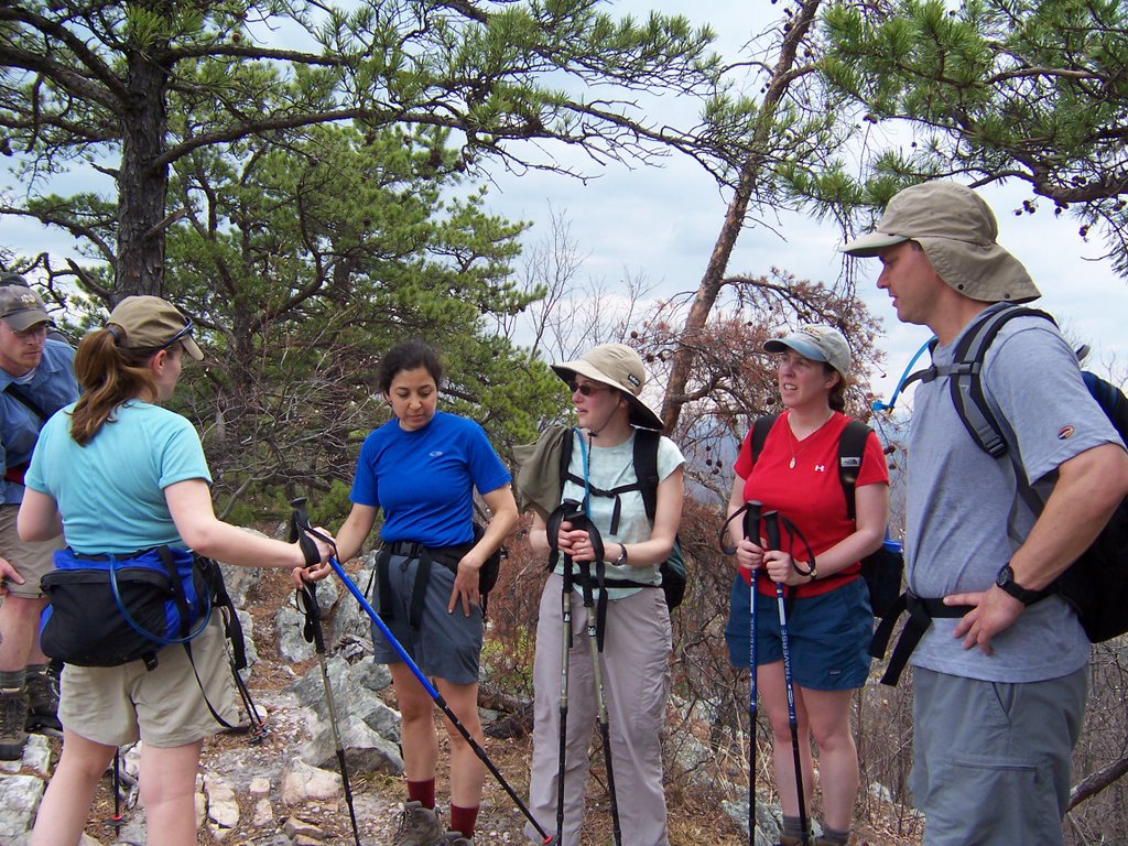
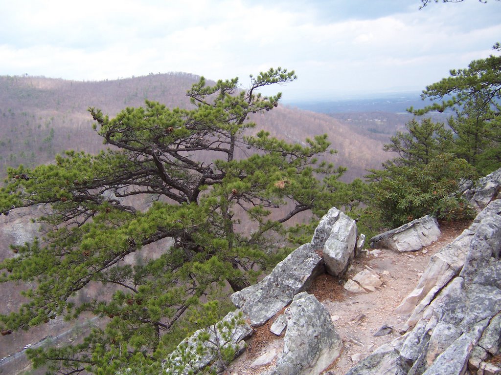
The Wilmington Trail Club.  Now, before you run out and start thinking about hiking this 36 miles of suburban fun, the only people allowed on the trail are member of the Wilmington Trail Club because some of it is on private property and you need special permission.  It starts somewhere in Pennsylvania and ends at the Brandywine Creek State Park in Delaware.  About 120 hikers were to load onto buses at 5AM and be driven in pitch dark to the trail head in Pennsylvania, where a whistle would be sounded at 6AM for the start of the race event.  

Before our bus left a nice man from the club informed us that the temperature was going to drop 10 degrees from where it was at now (50 degrees F) and it was going to rain all day.  Nobody left the bus, but I was a little suspicious because the 3 busses for the event didn’t seem very full.  I also don’t own any real hiking rain gear. As I had dressed earlier for the race event, I reached for my hiking boots only to find that in the Friday morning darkness I had grabbed two left-sided hiking boots from different pairs.  I was forced to work with the trail runners.   I had on my fleece jacket under a water-resistant bike jacket with my polyester-cotton blend yoga pants….and the trail runners.  I opted not to take the poles.

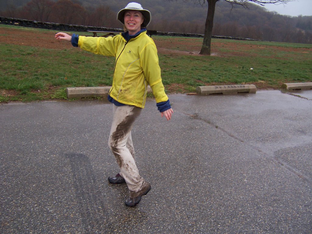
As soon as the whistle went off at the start it started to pour.  By mile 3 my feet were soaked.  Although the website described 12 miles of this trail was going to be on road, they really meant roads like with a double yellow line and cars and trucks.  What they didn’t tell us was that quite a bit of it was going to be on dirt roads, packed gravel roads and paved bike paths.  There were splashing cars, splash trucks, puddles, mud and more mud.  I had no poles so I couldn’t steady myself on the trail that was quickly turning into a very long slip-n-slide.  Conditions were harrowing.   Those that did take their poles found their fingers freezing into position around them due to the pouring cold rain.

Somewhere between checkpoint one and two, I don’t know whether it was when I fell on a slimy stream bank in the mud, when I had to traverse a freshly plowed field of mud (some farmer who owned land on the trail thought he’d show the hikers who was boss), or when I realized I could no longer feel my legs, I came up with the idea that I wasn’t having any fun.   At the checkpoint at mile 23, I (and just about everyone else who didn’t have proper raingear) opted to drop out.  The good news was that during the six hours that I raced participated in these hellish conditions, I managed to cover 23 miles, rendering my speed to be 3.83 mph.  During the shuttle back to the parking lot we passed Karen dressed neatly in hiking raingear who was still on the trail, she would have been maybe ½ mile ahead of me had a stayed in the race event.   I introduced myself to the other  drop-outs in the car and found out that 2 hikers, Tom and Barb, who I hadn’t met before but had heard legendary stories about their hiking abilities had also dropped out at the same place and time.  Barb was chattering pretty badly, Tom was doing his best to warm her up.  The hike organizers had told us they had to administer first aid to somebody on the trail who was suffering from hypothermia.  I am sure some more stories will be coming my way from this race event in the near future.

I just hate to have the words “dropped out” next to my name.


Update: They posted the picture album of the hike here.

Sherman Gap Trail revisted, Cindy Dee's restaurant

Yesterday I tagged along on yet another Mountain Club of Maryland hike. However, this hike was led by the dubious duo of Karen and Ron so you know there is going to be a story. The hike description said, "Be a fool and hike 15 miles on this scenic section of the Massanuttens." The key word in this description is "fool" as clearly the joke was on me.

As you can see from a previous post in January, I hiked this same trail with Patty and Dave and I knew from that experience that the elevation gain should be around 2000 feet. I figured Ron would add some mileage at the top of the ridge so the day shouldn't be that stressful....I should learn to ask more questions.

So, we start out at 7AM, we visit Karen's favorite diner, Cindy Dee's in Sandy Hook Maryland. Cindy Dee's is sort of a greasy spoon, with emphasis on greasy, but I was grateful for the breakfast stop. I innocently order a cheese omelet. Karen politely warns me that Cindy Dee's isn't the kind of place that uses real cheese, but I forge ahead with my order anyway. When I get my omelet I notice that much of the eggs weren't cooked but I figured the preservatives in the Velveeta would kill any wayward bacteria.

We get to the trailhead to meet up with Ron who has brought several hiking victims with him from some cabin they had rented. Ron makes some cursory statements about the hike that seemed somewhat vague, I don't listen very closely. We begin the ascent to Buzzard Rocks which went smoothly until I feel a warming sensation all over my body, I figure an early onset of menopause. The sensation gets worse and I start to clutch my aching stomach as I hike. By the time I get to the ridge I'm not feeling too well. Karen restates that she had warned me about the omelet order. It was at the crest that Ron then reveals that we are going to hike back down the mountain on the other side and then hike back up on the Sherman Gap trail,, resulting in double the elevation gain I though we were going to hike, his plan was to hike this mountain twice. At that point I become painfully aware of the potential ramifications of my situation.

Needless to say, my normally spunky hiking pace was seriously diminished. I did appreciate the lunch stop near the composting toilet at the Elizabeth Furnace trailhead though. Ron's cabin friends eventually caught on that this was going to be a severe death march, of which Karen and Ron are famous. Total distance was probably in the 15-16 mile range, elevation change was 3874 feet by a rough guesstimate.

On the way home we ate at John's My Pappy's Place in West Virginia, figuring that I may not survive two meals in one day at Cindy Dee's. Pappy's is on the West Virginia side of Route 340. It's clean, service is friendly and quick and the prices are cheaper than Cindy Dee's. Karen promises me that we will be having breakfast at Pappy's from now on.